
8+ Thru-Hikes Around the World: Alternatives to the Camino de Santiago
This article may contain affiliate links where I make a small commission for purchases you make from links that you click from this article. By purchasing through these links, you support me at no additional cost to you. Thanks for your support.
Long-distance thru-hikes and pilgrimages are addictive – I know because I caught the bug after I finished the Camino de Santiago in 2012.
“What next?” This is typically the first thought on people’s minds as they finish the Camino de Santiago thru-hike in Spain.
Finishing a thru-hike is exhilarating, exciting, and emotional. It’s a journey you put days, weeks, and sometimes months into, and you have truly become one with the trail. You walk, eat, and sleep…and then repeat. Your body changes, and your mind changes.
If you are like me and don’t like to do the same thing twice when there are so many other places in the world to explore, then you are looking for other thru-hikes similar in nature that will bring you the same excitement, challenge, and cultural exchange that the Camino did.
Ever since I completed the 500-mile-long Camino over the course of 5 weeks, I’ve been scouring the world for long-distance hikes similar to it in style, comfort, beauty, and challenge. Actually, I haven’t just been researching them; I’ve been doing them. I have amassed a number of alternatives in all parts of the world and have finally gotten around to writing about them all as a guide to alternative thru-hikes to the Camino de Santiago.
Table of Contents
What are Thru-Hikes and Thru-Hiking?
If you want to go down a rabbit hole of confusion, then look up the difference between thru-hiking, backpacking, hiking, and trekking. All of these are defined differently – there is no one universal definition. It also depends on where you are geographically, regarding what these terms mean to you.
Here’s the definition of thru-hiking, according to Wikipedia:
Thru-hiking, or through-hiking, is to hike an established end-to-end hiking trail or long-distance trail with continuous footsteps in one direction. Thru-hiking is sometimes called “end-to-end hiking.” Normally, a thru-hike is focused on long-distance and high-mileage hiking to complete a trail within a given timeframe.
And if you can’t complete a long thru-hike in the given timeframe, maybe you split it up into week-long sections, and this is generally referred to as section hiking.
Comparing Thru-Hikes to the Camino de Santiago

There are millions of thru-hikes in the world, but not all thru-hikes are created equal. When I set out on this challenge, I wanted to find thru-hikes that were similar to the Camino. I used these criteria:
- The hike doesn’t require you to camp. Lodging options are available.
- Eating options are available (restaurants or shops where you can buy food to make at your lodgings)
- Luggage transfer may be available
- The hike takes five days or more to complete
- The trail is well-marked
- There is an element of cultural interaction
Setting the Bar – What is the Camino de Santiago Pilgrimage?
The Camino de Santiago is the ultimate epic hike. It’s an ancient pilgrimage route to the shrine of the apostle St. James in the Cathedral of Santiago de Compostela in Northern Spain. There are dozens of routes that lead from all parts of Europe to Santiago de Compostela. However, the most popular route is the Way of Saint James or the Camino Frances.

It is a pilgrimage deeply rooted in Christianity. Legend has it that the remains of Jesus’s apostle, Saint James, lie in the cathedral in Santiago. However, the modern-day version of this is basically a 500-mile hike following the ancient pilgrims’ paths in Northern Spain. In essence, it is a long-distance thru-hike where you stay in hostels/albergues/hotels each night. Some people still do it for religious reasons, but many just do it to take on the challenge and enjoy the benefits of stepping away from the stress of the modern world.
Detailed Accounts of my Camino de Santiago Thru-Hike
Camino de Santiago FAQs
Camino de Santiago Packing List
Best Time to Walk the Camino de Santiago
Camino de Santiago Map
Total Distance: 450-mile walk across Northern Spain following the Camino de Santiago Frances Trail.
Difficulty
This is not a technical hike; it’s more about endurance than physically strenuous demands. The trail is pretty unobstructed, and you never really scramble up or down hiking trails. It’s more of a well-worn path that you walk on. However, endurance is not easy, and getting up and walking (no matter how flat the trail is) every day, day after day, for 5 weeks does take its toll on your feet and back. Most days, I woke up very sore.
Lodging
Albergues are the cheapest option, ranging from 4 to 10 Euros a night for a dorm bed. There are municipal ones and private ones, where the private albergues normally have a bit nicer conditions. You can be in a room of 10 people or 60 – you never know what to expect. Everyone shares a bathroom/shower, and there is normally a kitchen for you to use. Once you get used to sleeping with a crowd, they aren’t bad, and you can’t beat the price.
In most villages, there are also options to stay in more traditional ‘hotel’ rooms with private baths, such as a pension, a hostel, a casa rural, or a high-end hotel or historical building. Basically, a hostel and pension are the same – a budget hotel room (some have shared bathrooms), which is normally privately owned and small. A hotel is owned by a larger business and operates on a 5-star system, which also means it is a bit more expensive. A posada is normally a historical building that has been refurbished.
Best Time of Year to Hike the Camino de Santiago
I, of course, think that walking it in Spring (April/May) was the best possible time to do it! Yes, it did get rained on a bit, and it was muddy, but I will take those conditions any day over the heat and people!

A colorful path near Pamplona
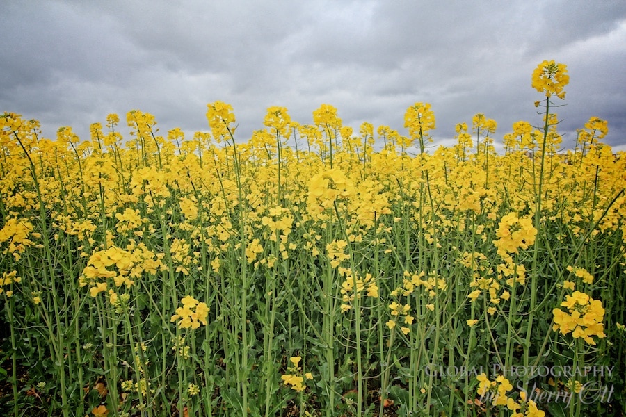 A sea of yellow flowers against the gray sky
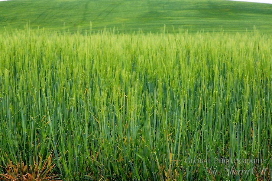 Fields of green as far as the eye can see along the Camino
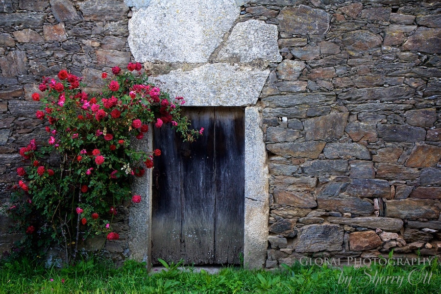 A rose bush in bloom – spring arrived!
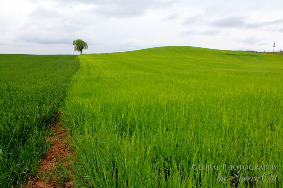 It’s not easy being green…views from the trail
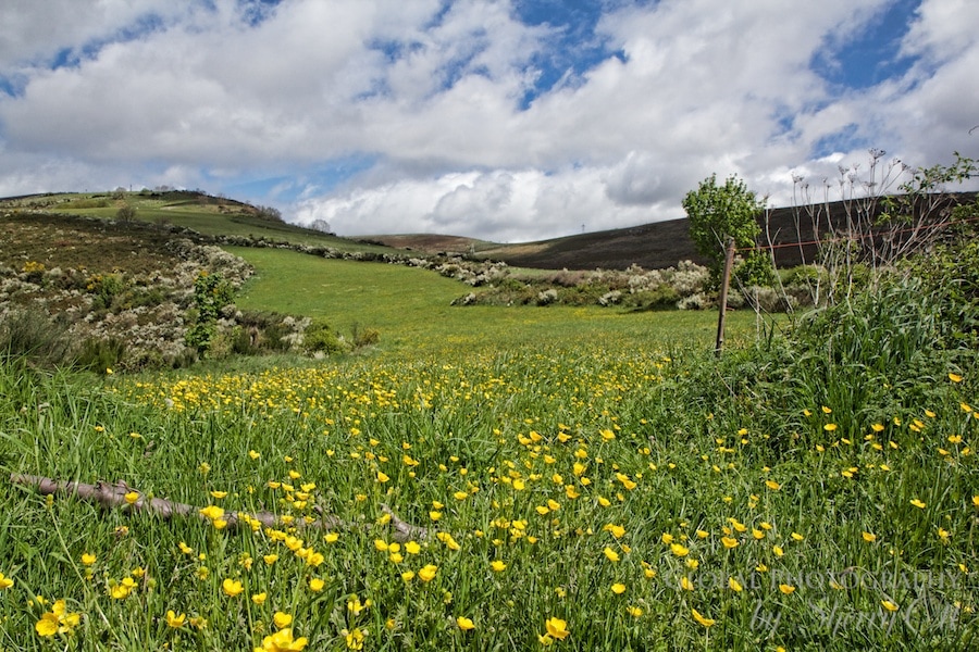 Spring has sprung on the Camino


Luggage Transfer
Yes, there are a variety of options for this along the Camino de Santiago. You can have it moved daily, weekly, or just move a bigger bag all the way to the end of the trail.
Check out my complete list of essential hiking gear I recommend for all of the hikes I write about.
Thru-Hikes Similar to the Camino de Santiago
1. Kumano Kodo Japan
Over 1,000 years ago, in the 11th century, Japanese emperors and their court would traverse the Kumano Kodo paths starting from the imperial city of Kyoto. They hiked into the forests of the Kii Peninsula to arrive at the three temples. These journeys would take 30 to 40 days and be considered spiritual journeys as they searched for heaven on earth. It is believed that the Gods live in these forests. Along the way, they would stop and purify themselves at the Oji’s (smaller temples). The journeys were often deadly due to the difficulty, and many people died along the route.

In May 2019, I hiked a portion of the 44-mile Nakahechi Route solo. I spent five days covering 33.6 tough miles from Takajiri-Oji to Nachi Temple and the waterfall. In addition, I spent a day hiking with a Yamabushi monk near Hongu in the mountains. I utilized Oku Japan and their self-guided package, where they organized all of my lodging and some of my transportation. It was a perfect way to experience this area on my own.
This is a thru-hike that is a ‘sister hike’ to the Camino de Santiago. They have banded together to offer a dual pilgrim status for pilgrims who complete both hikes with a pilgrim passport. They may be ‘sisters,’ but they are very different hikes. Here’s how they differ:
- It’s much harder! Proper hiking is required.
- It’s shorter – only 5 or 10 days compared to 4 or 5 weeks.
- There are fewer towns.
- There are fewer lodgings and restaurants along the path.
- Fewer people hike the Kumano Kodo trail.
Map of the Kumano Kodo and Kii Peninsula, Japan

Total Distance: Nakahechi Route 44 miles
Difficulty
It’s always hard to rate hiking difficulty because everyone is different. However, I do believe this was a moderate to strenuous hike. There are a lot of ups and downs in the route. But the good news is that you don’t have to deal with altitude.
My last day of hiking the Ogumotori-goe section was brutal, going up 2,600 feet in 2.5 miles. And then you had to go back down about 2000 feet to the temple! It was a hard day; my knees were screaming. Plus, it was at the end of the hike when my body was already pretty severely tired from the previous four days of hiking!
The multi-day aspect of the hike is also what makes it challenging. If you just walk for a day, it’s not that bad. But string 5 days in a row of that up and down, and you will feel it.
Lodging
My lodging in Kumano Kodo ranged from simple guest houses to fancy ryokan and onsen. I loved both! The Ryokans all were very traditional rooms, sleeping on the floor, and had incredible dinners included, while the guest house was much more personable – it was so nice to do both!
Note that, unlike the Camino de Santiago, you must plan ahead and make reservations for lodging since there is a limited supply in these small, remote villages.
Free camping is prohibited on the trail due to it being a protected area. There are a small handful of campsites (which may require reservations in advance) around the trail.
Best Time of Year to Hike the Kumano Kodo
The trail is open year-round. There is occasional snow in the winter. The best times to go are probably April to November. Note that in June, the rainy season starts, and it’s likely you’ll run into more rain in June/July. And beware of the humidity in September!
Holiday periods to be aware of (and you should likely avoid) – Japanese New Year holiday period (last few days of December, through around 04 January), some of the small, family-run inns may not be in operation, the Japanese Golden Week holiday period (last week of April through the first week of May), and Japanese Obon holiday period (typically 10 – 18 August). The busiest months are April, May, September, October, and November.


Luggage Transfer
Luggage transfer is available for the hike. However, you don’t need much luggage if all you are doing is hiking in Kumano Kodo while you are in Japan. Every place you stay along the trail will provide you with slippers that you must wear inside, and they also provide a yukata robe that you are encouraged to wear inside. So, honestly, all you need is your hiking boots and hiking clothes; the lodging takes care of the rest. They even provide toothbrushes, toothpaste, and all the toiletries you would need!
Learn More About How to Walk the Kumano Kodo
For a complete guide to the Kumano Kodo, read my article that answers all the important questions.
2. Saint Olav’s Way, Norway – Gudbrandsdalen Path
Head North to Norway for one of the latest pilgrimage routes that will rival the Camino. Saint Olav’s Way is the latest offering in pilgrimage routes in Europe, with seven different routes through rural Norway, all leading to Trondheim Cathedral, where the revered Saint Olav Haraldsson is said to be buried.
The historic trails that lead into Nidaros (Trondheim) have been used by pilgrims and other travelers since the year 1032. This is a way to walk in the footsteps of those ancient travelers and Scandinavian history and also take on an immense challenge.

The National Pilgrim Center in Trondheim manages 7 Pilegrimsleden paths. The paths lead through Norway, Sweden, and Denmark, the most popular travel path being the Gudbrandsdalen path from Oslo to Trondheim. I hiked a portion of the Gudbrandsdalen Path; 70% of the pilgrims walk this route.
Several pilgrim shelters were built along the path in the 1120s by order of King Oistein Magnussen to encourage pilgrims to do the walk. Today, some of those old shelters still stand, and you can even sleep in them! This path also has 6 Pilgrim Centers along the route, providing shelter for pilgrims and resources.
The revival and signposting of the ancient trails were started and completed in the late 90s. So, this is a relatively new hiking trail. In fact, it’s still so new that only 1,000 people have been recorded as having completed it in 2017!
Map of Saint Olav Ways Thru-Hike

Total Distance: 399 Miles/ 4 weeks – Gudbrandsdalen Path
Difficulty
This is always a hard thing to answer because each person’s definition of hard is different. This is evidenced by this conversation I had with one of our Norwegian guides as we walked up what I defined as a hill. “Today’s walk has a lot of hills,” I remarked to her as I was trying to catch my breath from being winded and my calves burned from the incline. “Hills? These aren’t hills,” She remarked, surprised. My hill might not be your hill. However, I firmly believe that Saint Olav Ways is more difficult than the Camino de Santiago.
Lodging
There are pilgrim hostels and housing along the way. However, they are spaced out further, and they must be planned ahead. It is not recommended just to show up and expect a bed. Not because the route is too busy – but really just the opposite; it’s not that busy, so people aren’t always prepared for your arrival. Plus, many of the pilgrim farm stays are working farms that provide lodging as a secondary activity, so they are not always there ready to cater to pilgrims 24/7.
Best Time of Year to Hike Saint Olav’s Way
The optimum hiking season for the Saint Olav Ways Path is May to August. This is where the lodgings and the various pilgrim centers are open. Starting in September, you could potentially be dealing with some pretty foul weather and short days.


Luggage Transfer
There is currently no way to have your bag transported daily along the route. They hope to have this feature eventually, but you will need to carry your own.
Also, note that there are other St. Olav Ways routes to choose from. All of them end in Trondheim. I didn’t do it, but I had a friend hike the St. Olavsleden pilgrim path, which begins in Selånger, Sweden, for nearly 372 miles west to Trondheim, Norway.
Learn More About How to Walk Saint Olav Ways
Saint Olav Ways Frequently Asked Questions
Why walk the Saint Olav Ways
Guidebooks in English are rare, but this is one that was recommended:
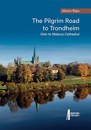
The book is primarily aimed at the "long-haul" pilgrim, who walks in a single journey, alone or with few companions. It provides step-by-step walking instructions from one place to the next, plus a list of the facilities available, and history of places of interest. Perfect for planning!
3. East Coast Trail, Newfoundland, Canada
The East Coast Trail is a series of 26 rugged hiking paths totaling over 186 miles along the Avalon Peninsula in Newfoundland. The coastline, which is home to the trails, was ranked the world’s top coastal destination in 2016 by National Geographic.

While tackling the East Coast Trail, you’ll be exposed to the culture as you hike through and stay in small communities. The Newfoundland culture is one of the highlights of the whole experience! You’ll also see wildlife like whales, seals, and various birds, and if your timing is right, you may even see icebergs floating down Iceberg Alley!
I didn’t have time to hike the entire trail. Instead, I did a sampling of the trail with Great Canadian Trails self-guided hikes. They offer a “taste of the trail” in less than a week! This 6-day taster will take you to the picturesque fishing village of Quidi Vidi, Signal Hill, hiking to the dramatic Berry Head sea arch, while you also enjoy Cape Spear Path at the most easterly point of the continent, and finally, it will test you on the rugged Flamber Head Path. These are some of the best hikes of the entire trail, and you’ll have a well-rounded experience on the trail in only a week. Plus, all of the logistics will be taken care of, so you can just enjoy the trail.
Map of the East Coast Trail, Newfoundland

Total Distance: 186 miles
Difficulty
The East Coast Trail is described as ‘Introductory/Moderate’. I personally would rate it as moderate. The primary challenge is in the ruggedness of the trails. There are a lot of short ups and downs, and it can be steep in some areas. In fact, more than once, I was scooting down on my butt due to steep erosion!
Altitude is not a problem; it’s more of a rolling terrain. Hiking is definitely harder than hiking in the Camino de Santiago. Due to the harder trails, you don’t typically go far distances. My average day was 9 miles.
Lodging
If you love thru-hikes where you have nice beds to stay in, then put the East Coast Trail on your list! The Great Canadian Trails’ self-guided multi-day hike accommodations were different than other thru-hikes I’ve done. Instead of hiking from place to place and staying at the endpoints, you often stayed at one B&B for a few nights at a time. I enjoyed staying at a B&B for multiple nights and having transportation to the various trailheads! This also meant that I was able to hike with just a day pack instead of a bigger backpack!
Best Time of Year to Hike the East Coast Trail
The trail is really only accessible in the summer months. We were there in mid-July, and the weather was perfect! Because Newfoundland is so far north, their summers are still rather cool and short. The best times are likely between July and mid-August for temperatures and weather.
However, if you want to see icebergs along the trail, then you’ll want to be there in May or June. These are the best times to see icebergs floating along Iceberg Alley! They will come drifting (very slowly) right by the trail in many places!


Luggage Transfer
Yes. Your luggage has been moved by Jamie, who also handles all of your transportation for the Great Canadian Trails.
Learn More About How to Walk Saint Olav Ways
Read my article on hiking the East Coast Trail in Newfoundland.
4. Lycian Way, Türkiye
Lycia is the historical name of the Tekke Peninsula, which juts into the Mediterranean on Türkiye’s southern coast. The Lycian Way is a 509 km, 25-day way-marked footpath around the coast of Lycia in southern Türkiye, from Fethiye to Antalya. The Lycian Way takes its name from the ancient civilization that once ruled the area.

The Lycians were democratic but independent, warlike people with a developed art style and a high standard of living. Their strategic position gave them unique opportunities for sea trade and (at times) for piracy. After Persian rule, the Lycians welcomed Alexander the Great and absorbed Greek culture.
Later, Lycia became a province of the Roman Empire; as it crumbled, many Byzantine monasteries were founded in the Lycian hills. The Lycians’ graves and ruins abound on the peninsula, and the Lycian Way passes many remote historical sites.
The Lycian Way is a combination of several ancient routes of the Lycian people. The overall hiking route was created by Brit Kate Clow. You’ll hike along the rocky coastline, float in the turquoise waters of the Mediterranean, cross deserted beaches, and explore ancient ruins and tombs in this challenging thru-hike.
Unlike the other thru-hikes listed here, you will have to camp some nights as the villages are too far apart in some areas to find lodging and food every night. So, this is a thru-hike where you’ll have to carry a bit more gear and be prepared to rough it more.
I hiked half of the route from Kas to (nearly) Antalya, which took about 2 weeks.
Map of the Lycian Way Thru-Hike
Total distance: To walk the entire route, it’s 509 km (300 miles). It will take approximately 25 days to complete.
Difficulty
The Lycian Way is not a long-distance walk – it’s a long-distance hike. Hiking boots and gear are necessary; the trail is rough, and there is lots of climbing and descending along the coastline. Walking poles are very helpful. There are stretches where you are not near villages for a few days, so camping gear is necessary. I personally found the Lycian Way to be much more physically challenging than the Camino de Santiago and more in line with the Nepal Annapurna Circuit trek, where you hike in the Himalayas.
Lodging
You can stay at pansiyons (pension, guest house) in many of the villages. These are typically simple homes/rooms, including breakfast at no cost. They rent out rooms in a home much like a guesthouse. It’s quaint but nice, and they have clean showers and food. However, there is not always a village to stop at within a day’s walk, and that is what makes the Lycian Way a bit of a challenge at times. This means you either have to camp or plan ahead and ensure you can get transportation to a village with a pansiyon where you can sleep at the end of your hiking day.
You can also stay in hotels or even on a boat like the Selin-3 along certain parts of the trail from Kas to Demre. But many people choose to camp. You can carry your hiking gear and camp anywhere you can find a flat spot, but there aren’t many campgrounds with facilities. It’s a regular ‘roughing it’ type of camping.
Best Time of Year to Hike the Lycian Way
April/spring is the best season.
The summer months are very hot, and I wouldn’t recommend hiking then.
We hiked from mid-October to mid-November to try not to be in the superheat of the summer. This was a great time to hike climate-wise; however, many things closed in the fall when we went, and as the tourist season was finished, it was a bit harder to find places to sleep and eat. But the tradeoff was that it was much cooler and that it was worth it. One other thing to note about hiking in the fall is the days are short, so plan your route with that in mind.


Luggage Transfer
No – there are no options for this. The trail is not as supported as other thru-hikes. There isn’t a lot of infrastructure or businesses set up to cater to hikers on the Lycian Way. If you choose to do the hike with a tourist company, they will likely be able to transport your bags.
Learn More About Hiking the Lycian Way
Lycian Way Frequently Asked Questions
Lycian Way guidebook

5. Costa Brava Coastal Path, Catalonia, Spain
What started as small footpaths along the cliffs to connect fishing villages in the 19th century evolved into police surveillance and border patrol routes to stop smuggling along the Catalan coast in the 20th Century. This is essentially how the name Camino de Ronda came to be. ‘Ronda’ means beat or patrol. However, after the 1950s, the paths started to disappear in lieu of urban development and lack of use. Now, there’s an effort to reinstate the coastal footpaths (also known as Camino de Ronda) that connect the modern-day villages and run along the spectacular Mediterranean coast of Catalonia, Spain.

I completed 100 miles of the 135-mile Camino de Ronda and Coastal Paths of Costa Brava, Spain, experiencing the same type of long-distance walking satisfaction and excitement that I had in the Camino de Santiago. So, if you are like me and are looking for a new long-distance village-to-village hike, Costa Brava offers an excellent alternative: less crowded, intense culture, and beautiful coastal views the whole way.
Some sections of the Camino Ronda are well-maintained and refurbished, but others are still overgrown or too treacherous to hike along the coastal cliffs. Other major hiking paths have been created, though, to connect the various sections of the old Camino de Ronda and essentially create a complete coastal hiking system along the Costa Brava.
One such path is the GR-92, part of the Grand Randonnee European long-distance path system. It’s a well-marked and maintained path running the entire Catalan coast. Where the Camino de Ronda is not walkable or not well connected, the GR-92 snakes inland into the Costa Brava farmlands, providing a fun variety of coast and inland hiking.
Map of Costa Brava Coastal Path

Total Distance: 135 Miles from Blanes to Portbo
Difficulty
This is a coastal hike, so first and foremost, you can expect a lot of ups and downs. The coastal trails are normally described as moderate. However, depending on the trail and the day, it can range from easy to difficult.
Most of the coastal paths run along the coast, traversing peninsulas and coves that jut out like fingers. This means you will rarely be hiking in a straight line from point A to point B. Instead, you will be going in and out of each little peninsula and cape as if you were traversing in and out, fingers on a hand.
In addition, along the coastal paths, you tend to continuously go up and down from the rugged cliffs to the secluded beaches. Oftentimes, there are stairs (sometimes rather steep) around the more developed areas and communities, which makes the footing easier, but it’s still up and down. However, on other parts, it is simply a dirt trail and can be quite steep at times.
Lodging
Towns and lodging are spaced out along the trail so that it’s easy to find lodging each night in any of the coastal towns along the path. You can stay in high-end premium hotels, go basic and choose hostels, or even do Airbnb in the towns. If you book with a tour company, they will help you arrange hotels each night based on your route. If you hike independently, you can book your own hotels. During the busy summer months of June, July, and August, as well as on weekends, you’ll want to reserve in advance. However, if you are hiking in the off-seasons of Spring and Fall and on weekdays, you can likely get a hotel room the day you arrive.
Check out this Costa Brava fishing experience like no other
Best Time of Year to Hike the Costa Brava Coastal Path
You can hike the coastal trails at any time of the year, including winter, because the temperatures are mild year-round. I hiked in late May, and it was lovely.
Summer (July/August): This is the most popular time to hike the coastal paths because tourism is at its height; however, so is the temperature. The good news is that coastal hiking normally always has a nice coastal breeze that helps keep you cool, not to mention the tree cover in the southern part of Costa Brava. However, once you reach Cadaques and beyond, in the northern part of Costa Brava, the heat really takes hold since there are practically no trees and shady spots in this region. The big advantage to going in during the busy summer months is that the Mediterranean water is warm, perfect for swimming or just cooling off in the middle of a hike.


Spring & Fall (April/May/September/October): If you are looking for cooler hiking temperatures and fewer people – then consider going in the off-season. The temperatures are cooler (perfect for hiking). However, you may run into a bit more rain.
Luggage Transfer
Most companies that offer tours will offer luggage transport. However, if you want to hike independently and go pack-free or pack a day, then you can hire the services of a company like Cami de Ronda or Costa Brava Walks, which will move your luggage from hotel to hotel.
Learn More About Hiking the Costa Brava Coastal Path
Everything you need to know about hiking the Costa Brava Coastal Path
Top 5 Costa Brava Day Hikes
6. Annapurna Circuit, Nepal
The Annapurna Circuit is a thru-hike within the mountain ranges of central Nepal. I hiked it with my father 11 years ago before I had even heard of the Camino de Santiago. This hike crosses two different river valleys and encircles the Annapurna Massif. This means the views are incredible at all times. Keep in mind that it is a serious thru-hike with altitudes not to be taken lightly. The path reaches its highest point at Thorung La Pass at 17,769 ft.

The total length of the route varies between 100 and 145 mi, depending on where motor transportation is used and where the trek ends. The route is normally hiked counterclockwise because the daily altitude gain is slower and safer. Since I’ve hiked it, there have been roads built in some areas, and sometimes that is off-putting to people. However, it is good overall for the villages in terms of their health and prosperity. Quite frankly, I believe this area and culture is so incredible – a few roads are not going to hurt your overall experience. The Annapurna Trek is not just about the views – it’s just as much about being immersed in how locals live.
This long-distance hike will take you through a variety of different landscapes, from the humid, lush rice terraces to the forests and then into those beautiful high-altitude views. It really does have it all, but you have to work for it.
If you want to immerse yourself in the majestic Himalayas and also be immersed in the small village culture and agriculture, this is the trek to do.
Map of Annapurna Circuit

Total Distance: 100 to 145 miles. The trek begins at Besisahar and concludes in the Kali Gandaki Gorge. Besisahar can be reached after a seven-hour drive from Kathmandu.
Difficulty
Due to the rough trails, long distances, and high altitudes, this trek is quite difficult and requires good training and endurance. The trails are rugged and often steep and narrow with uneven footing. The Annapurna trek is long, tiring, and physically and mentally tough, so make sure you build some rest days into your plan. However, I did do the trek with my father, who was 73 at the time…so if he can do it, so can you!
Lodging
One of my favorite things about this thru-hike is staying in the rustic and simple tea houses. These are very simple ‘guest houses’ in villages where you get a bed (normally twin share), and you can often eat there. The bathrooms are shared and simple. You typically don’t have to book lodging in advance. There is always a shared area where you eat, gather around the fire, and socialize.
Best Time of Year to Hike Annapurna Circuit
The best times for thru-hiking the Annapurna Circuit are October – early December and late February – April. These are the best times to be able to cross the high-altitude pass. It can be really dicey and often closed at other times. Also, if you go before October, you run the risk of monsoon season and muddier trails with mudslides.
I hiked it in October and loved experiencing the fall colors at lower altitudes.


Luggage Transfer
Yes, luggage transfer is available through a Nepalese porter. These men and women are experts at carrying your gear on the trail; it’s amazing to see them carry your bags strapped around their foreheads.
We hired a guide and a porter to go with us on our trek, and it was a great way to do the trek independently. Our porter carried our heavier gear, and we just took our daypacks. We were normally able to stop in a village for lunch.
However, porter weights are regulated for their protection. Nepalese porters will carry 10kg of your gear.
Learn More About Hiking the Annapurna Circuit
My Annapurna Circuit Itinerary
Read the narrative story about how my father and I conquered the Annapurna Circuit with our guide and porter.
7. Alta Via 1 Hike Dolomites Italy
I was there to take on the Alta Via 1, a multi-day hike traversing through the heart of the Dolomites. It can take anywhere from 8 to 12 days, depending on your speed. The trek offers panoramic views of the iconic jagged peaks, turquoise alpine lakes, and rolling green meadows that make the Dolomites such a unique and beautiful landscape.

The Alta Via 1 hike utilizes the mountain hut system (rifugios), where you can sleep and eat, making it one of the world’s most popular thru-hikes. ‘Rifugio’ means ‘shelter’ in Italian, but it is also interchangeable with ‘mountain hut.’ However, there are no basic huts…you’ll be well taken care of and comfortable at the Rifugios!
Map of the Alta Via 1 Hike


Difficulty
I would rank this a moderate to hard hike. We hiked nearly 50 miles with average daily elevation gains/losses of 2700 feet – this certainly wasn’t easy. However, I have seen some people write about it as an easy hike – so I guess it’s ‘to each their own.’


I found it really challenging. There were times we had to scramble up boulders, there were lots of steep switchbacks, and the trails were rocky in general. You got as high as 8,900 ft, so at times, you also had altitude to contend with.


Lodging
The Rifugios (mountain huts) were a slice of heaven, a warm place full of joy and friendship, filled with a special feeling of freedom that only the mountains are able to supply. I love hiking all day, pushing myself, and then having a cozy place to stay for the night. The Dolomites are littered with cute rifugios in stunning, remote locations – these are your ‘homes’ for the night. They range in design and quality; however, it’s really the people you are with, as well as other hikers, that make the experience.


Most Dolomites Rifugios offer dorm accommodations with anywhere from 4 to 16 people in a room. Most that we stayed in were 4 to a room. They furnish bedding, but you may want to bring a sleep sheet and earplugs (see gear list below). All of the rifugios we stayed in were on the nicer end (thanks to the group trip!) and offered incredible views, hot showers, wifi, common areas, and food/drink. A perfect place to clean up and rest after a long trail day!
Best Time of Year to Hike the Alta Via 1
I’m biased…but I’m pretty positive the best time of the year to do the Alta Via 1 hike is in September. And yes, this is when I went. The trails and mountain huts don’t fully open up for the summer until mid-June, and they stay open until the end of September.
That means that most people hike in the Dolomites in July and August. The rifugios are normally booked up in advance, and there are quite a few people using the trails since people are on school holidays. It’s also much hotter.

In September, when school is back in session and summer has been forgotten, this is the time to go! It won’t be empty trails, but it will be more reasonable.
Luggage Transfer
You’ll be able to have your luggage moved from Rifugio to Rifugio on a group hike. It makes the hike so much more enjoyable when you have to take a day pack. On my trip, the luggage support ran like clockwork. Every day when we showed up at our endpoint, our luggage would be there waiting for us, and we could change into comfortable shoes and clothes!
There were two huts on our route where no luggage support was available since there were no roads there. On those days, our luggage was moved to the next hut with road support, and we just packed a few extra things in our daypack for that night.
Learn More About Hiking the Alta Via 1
Read my article about hiking the Alta Via 1 in the Dolomites with a Group.
8. Michinoku Coastal Trail Hike
Looking for scenery and culture? Then head to Tohoku, Japan. Established in 2012, the Michinoku Coastal Trail is a 620-mile hike full of stunning ocean views, diverse landscapes, and deep connections with local communities.
I was surprised when I heard that Japan had created a new long-distance hike around one of Japan’s most deadly disasters – the 2011 East Japan earthquake and tsunami. The region experienced so much pain and suffering,g with over 20,000 people perishing. However, I also understood why it was a good idea to bring more visitors and knowledge to the Tohoku region – they needed to rebuild the coast and encourage the healing of the region.
If you are looking for more great hikes around the world that may be a little shorter, then be sure to check out the Best Hikes in the World I’ve Done article!
In 2023, I traveled to Japan to hike the Michinoku Coastal Trail (MCT). I was excited to experience the history, adventure, and views of the MCT, as well as learn about the disaster and resilience of the people. The trail’s mission is to commemorate the lives of the people lost in the tsunami and keep their legacy going. It also helps the region’s economy by encouraging more tourism in Tohoku.

The trail includes three different geographies: cliffs, peninsulas, and coastal beaches. Municipalities consisting of 150 volunteers maintain the trails. Engaging with local culture and cuisine, from traditional ryokans to unique dining experiences, adds depth to the hiking adventure along the trail. This is more than just a hike; it’s a cultural journey.
Map of the Michinoku Coastal Trail
Difficulty
The trail is moderate in hiking difficulty. If you take on the entire trail, it’s a 40 to 50-day challenge. That amount of prolonged time on the trail makes it more difficult. The northern part of the trail is more technical and includes a lot more ascending and descending.
There is a good deal of road walking in addition to traditional trails. Luckily, there are a number of towns located along the route, so there are plenty of places to rest and


Lodging
Accommodation along the Michinoku Coastal Trail ranges from campsites to traditional Japanese inns, catering to various preferences and budgets. Booking in advance is recommended, especially during peak hiking seasons, to ensure availability and a smooth experience.
Whether you prefer the rustic charm of a campsite or the cultural immersion of a ryokan, the trail offers a variety of options. Many accommodations have hot springs/onsens, allowing you to relax and rejuvenate after a day of hiking.


Japanese Style Hotels
Staying in traditional Japanese inns, known as ryokan, provides a culturally immersive experience along the Michinoku Coastal Trail. These inns offer amenities like tatami mat rooms, futon bedding, and kaiseki meals. Ryokans not only provide a comfortable place to rest but also enrich your journey with authentic Japanese hospitality. The combination of traditional amenities (indoor/outdoor onsen and futons) and stunning natural settings makes staying along the Michinoku Coastal Trail a memorable experience.
Campsites
Campsites along the Michinoku Coastal Trail offer a unique way to experience the great outdoors. Facilities like the Kamiwarisaki Campsite, which features ocean views and amenities for BBQ, showers, and baths, are popular choices for hikers. These campsites provide essential facilities such as restrooms and cooking areas, enhancing the outdoor experience. However, it’s important to note that some campsites may close during winter, so planning ahead is essential.
As part of my tour, we glamped at Tanesashi Natural Lawn in Aomori Prefecture. The lawn is a rare coastal grassland where lush green grass grows naturally right up to the edge of the Pacific Ocean. You are treated to a delicious barbecue with local meats and seafood, and get to fall asleep to the crashing waves.
Best Time of Year to Hike the Michinoku Coastal Trail
The best time to hike the Michinoku Coastal Trail is during spring (late March to early June) and autumn (September to November). These seasons offer pleasant weather and stunning scenic views, making your journey more enjoyable. While the trail can be hiked year-round, seasonal conditions vary, and it’s important to be prepared for the changes in weather.
No matter when you choose to hike, you’re likely to find the trail relatively uncrowded, allowing you to immerse yourself fully in the natural and cultural beauty of the Tohoku region. Each season brings its own unique charm, from the blossoming flowers of spring to the vibrant foliage of autumn.
Luggage Services
Luggage delivery services offer convenient options for hikers, allowing you to focus on your hike without the burden of heavy bags. All companies that offer self-guided tours also provide luggage services. However, if you are doing it entirely on your own, then you may want to consider hiring a regular luggage moving company and having them move your items a couple of days down the road, and then to the end.
Takkyubin, a door-to-door delivery service provided by Yamato Transport, allows you to send your luggage between different locations within Japan, including hotels, airports, and even convenience stores like 7-Eleven, essentially acting as a luggage forwarding service.
Learn More About How to Hike the Michinoku Coastal Trail
Michinoku Trail Club Website
Michinoku Trail Website – created by an English tourist who hiked the entire trail
Check out my complete list of essential hiking gear I recommend for all of the hikes I write about.
Best Thru Hiking Gear
Mostly, the gear you want to take is standard hiking gear – and you can find that in my Essential Hiking Gear Post.
However, there are a few things you’ll want that are really unique to thru-hikes or multi-day treks.
The right backpack for a long multi-day hike is essential:
I use the Deuter Futura 45 + 10 pack on many of my thru-hikes. It’s 55L, can carry a sleeping bag/quilt, and has space for multi-day hikes. This is the perfect size for multi-day hikes where you aren’t carrying a tent. This particular pack is part of Deuter’s women’s series. It has a Vari-Slide System that allows exact adjustment to every back length, ensuring the pack sits perfectly on your hips. Plus, the waist belt also moves with you as you step, ensuring comfort for long-term wear.

Perfect for multi day hut to hut hikes where you are carrying more gear. The Vari-Slide System allowing exact adjustment to every back length, ensuring the pack sits perfectly for women of any size.
Sleeping Gear for Thru Hikes
For many of these thru hikes, you are staying in hostels, guesthouses, or sometimes camping. I recommend you bring a sleep sheet with you – it’s small, lightweight, and perfect for a thru-hike. I also like to bring a down quilt for thru-hikes with chillier weather.


Nearly weightless and packable, the 32F/0C down quilt for three-season camping and backpacking offers high-performance warmth, with a tiny packed size that weighs just 16 ounces.
Laundry Gear
Thru-hiking means packing light and washing out hiking clothes often. Make sure you take some laundry gear.

The Travel Clothes Line makes it easy to rinse out a bathing suit after a swim or other items as needed with a simple drip-dry system. Ideal for travel. This compact clothesline allows you to wash clothes at night and have them dry by the next day. Easy to pack.

This super concentrated Wilderness Wash goes a long way and is gentle on fabrics and skin, but effective on dishes and laundry stains. The bottle it comes in is tough enough, and the lid is secure enough, so you don't have to worry about leakage in your pack or bag.
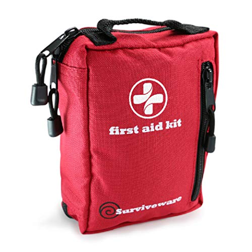
First Aid
Finally – make sure you have a good first aid kit and blister repair gear!

Continuing the Quest For Camino Alternatives
By no means is this a complete list of thru-hikes, and by no means am I done finding new ones! This is a list I will continue to add to as I tackle more of these caminos around the world. Here are a number that I have my eye on!
9. Jordan Trail
The Jordan Trail is a long-distance hiking trail in Jordan connecting the length of Jordan from Umm Qais in the north to Aqaba in the south, offering 40 days of hiking over more than 403 miles of trail and traveling through 52 villages and towns on its way. The trail traverses the diverse landscapes and vistas of the country, from the rolling wooded hills of the north, the rugged wadis and cliffs overlooking the Jordan Rift Valley, the rose rock of Petra, the dramatic sands and towering mountains in Wadi Rum, to the crystal waters of the Red Sea.
10. Via Francigena, Italy
A 1,242-mile long-distance trail from Canterbury to Rome. This ancient path will take you over easy mountain paths, mule tracks, rural and secondary roads, cypress-lined dirt roads, or those shaded by majestic pines until you reach the “cobblestones” of Rome. The trail will take you through villages where all roads lead to Rome.
In 2018, I actually walked for a day on the trail in Tuscany to learn more about it. It was a great taste of what to expect and how difficult the trail was.
11. Portuguese Way
One of the many Camino de Santiago routes, the Portuguese Way, has always been on my list. I like the idea of walking through a new country and a less crowded trail. The Portuguese Way is 383 miles long, and you can stay in villages along the way.


I would suggest “Kungsleden” in arctic Sweden – 3-4 weeks of north-south or south-north hiking. Or you can split it up (I did the northern half in 2 weeks). It’s hut-to-hut hiking or you can tent. Youtube has many videos.
Also, while hiking Kungsleden I talked to some Israeli girls who highly recommended the Israel National Trail. https://www.israeltrail.net/
https://www.google.co.uk/amp/s/amp.theguardian.com/travel/2016/aug/27/georgia-new-transcaucasian-hiking-trail-project
The new Caucasus trail looks interesting
Don’t forget cost to coast in Costa Rica.
I’d love to learn more – is there a website about it?
Camino de Costa Rica…they have an insta and you can Google it.
You’re absolutely right! I got back from walking the Camino del Norte (Irun-Muxia/Finesterre) 10 days ago and I am totally “What next?!?!?” That was my first thru hike ever and I am beyond delighted in being privy to this fountain of life. Thank you for this article and being a pillar in the path of pilgrims and thru-hikers throughout time. I’ve got my eyes set on a few of the routes you’ve mentioned and happy to add the ones added by previous commenters. Once again, thank you!
I found the Portuguese way to be uninspiring. I would swap out the Portuguese Way for the Fisherman’s Trail, also in Portugal.